Eure
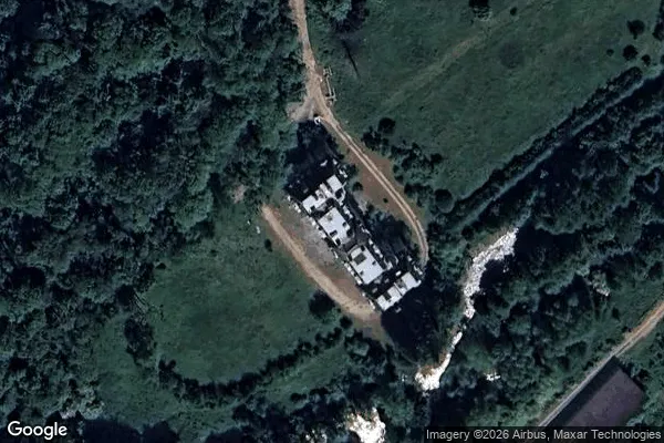
Mapa Urbex Château de Radepont, Radepont
EureNormandieFrancja
Dożywotnie aktualizacje
- Zamki
Château de Radepont, Radepont - Coordonnées GPS Urbex
Obtenez la coordonnée GPS exacte de ce lieu abandonné situé dans le département Eure (Normandie, Francja). Spot urbex vérifié et géolocalisé.
Radepont (French pronunciation: [ʁadpɔ̃]) is a commune in the Eure department in Normandy, northern France. It is located 22 km south east of Rouen, on the river Andelle.
0,90EUR
Paiement unique - accès à vie
Płatność w 100% bezpieczna
AMEX
Google Pay
stripe
Połączenie szyfrowane SSL · Brak przechowywania danych bankowych
Ce qui est inclus
- Coordonnée GPS exacte
- Photo satellite du spot
- Accès immédiat après achat