Menu
Texas

Urbex Map Brazoria

72 abandoned places in Brazoria

Urbex Map Brazoria

72

spots

4,90 €

One-time payment - lifetime access

Regular lifetime updates

All abandoned places in Brazoria

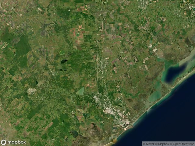
72 verified GPS coordinates in the department of Brazoria, Texas, United States.

Looking for abandoned places in Brazoria, Texas, United States? Urbex Maps offers 72 verified GPS coordinates of abandoned buildings in this area, including .

  • 72

    verified spots

  • GPS

    Google Maps, Waze

  • June 2026

    last update

Where to find abandoned places in Brazoria?

The best way to find abandoned places in Brazoria is through the interactive urbex map on Urbex Maps with 72 verified GPS coordinates. Top categories are .

Spots in Brazoria

8" Hydrogen Air Liquide to Seagas

8" Hydrogen Air Liquide to Seagas

0,90 €
Amoco Chemical Company

Amoco Chemical Company

0,90 €
Ascend Performance Materials Pipeline - Line 4

Ascend Performance Materials Pipeline - Line 4

0,90 €
Avenue D, Danbury

Avenue D, Danbury

0,90 €
Baldwin Road, Freeport

Baldwin Road, Freeport

0,90 €
Bear Wallow Lateral

Bear Wallow Lateral

0,90 €
Brazoria County, Texas

Brazoria County, Texas

0,90 €
Brazoria County, Texas

Brazoria County, Texas

0,90 €
Brazoria County, Texas

Brazoria County, Texas

0,90 €
Brazoria County, Texas

Brazoria County, Texas

0,90 €
Brazoria County, Texas

Brazoria County, Texas

0,90 €
Brazoria County, Texas

Brazoria County, Texas

0,90 €
CR 160

CR 160

0,90 €
CR 310

CR 310

0,90 €
CR 314

CR 314

0,90 €
CR 314

CR 314

0,90 €
CR 604

CR 604

0,90 €
CR 729

CR 729

0,90 €
Chenango

Chenango

0,90 €
Chenango

Chenango

0,90 €
Chenango

Chenango

0,90 €
Chenango

Chenango

0,90 €
Chocolate Bayou - Old Texaco Line

Chocolate Bayou - Old Texaco Line

0,90 €
Cooper Road, Lake Jackson

Cooper Road, Lake Jackson

0,90 €
DOW Plant A, Brazoria County

DOW Plant A, Brazoria County

0,90 €
Danbury-Liverpool Road, Alvin

Danbury-Liverpool Road, Alvin

0,90 €
East State Highway 332, Freeport

East State Highway 332, Freeport

0,90 €
FM 521, Angleton

FM 521, Angleton

0,90 €
FM 521, Angleton

FM 521, Angleton

0,90 €
FM 523, Freeport

FM 523, Freeport

0,90 €
Freeport

Freeport

0,90 €
GC Petrochemical & Feedstock Pipeline

GC Petrochemical & Feedstock Pipeline

0,90 €
Ineos - Stratton Ridge Facility, Brazoria County

Ineos - Stratton Ridge Facility, Brazoria County

0,90 €
Levee Road, Clute

Levee Road, Clute

0,90 €
Levee Road, Clute

Levee Road, Clute

0,90 €
Mobil, Alvin

Mobil, Alvin

0,90 €
North Business State Highway 288

North Business State Highway 288

0,90 €
Oak Park Drive, Alvin

Oak Park Drive, Alvin

0,90 €
Old Ocean

Old Ocean

0,90 €
Old Quintana

Old Quintana

0,90 €
Old Surfside Road, Freeport

Old Surfside Road, Freeport

0,90 €
Oyster Creek Bend Road, Oyster Creek

Oyster Creek Bend Road, Oyster Creek

0,90 €
Perry Landing, Jones Creek

Perry Landing, Jones Creek

0,90 €
Peterson Landing

Peterson Landing

0,90 €
Quintana, Freeport

Quintana, Freeport

0,90 €
SWEENY-OLD OCEAN LINE IDLE

SWEENY-OLD OCEAN LINE IDLE

0,90 €
State Highway 288

State Highway 288

0,90 €
State Highway 6, Alvin

State Highway 6, Alvin

0,90 €
State Highway 6, Manvel

State Highway 6, Manvel

0,90 €
Sweeny

Sweeny

0,90 €
Sweeny

Sweeny

0,90 €
Sweeny

Sweeny

0,90 €
TX 35, West Columbia

TX 35, West Columbia

0,90 €
Tin Road

Tin Road

0,90 €
Traces of Mapped Silence

Traces of Mapped Silence

0,90 €
Valero Producing Randall #1 Lateral

Valero Producing Randall #1 Lateral

0,90 €
Velasco Heights

Velasco Heights

0,90 €
Velasco Heights

Velasco Heights

0,90 €
Velasco Heights, Freeport

Velasco Heights, Freeport

0,90 €
Vertices of the Void

Vertices of the Void

0,90 €

+ 12 more spots

Urbex FAQ for Brazoria, United States

Is urban exploration legal in Brazoria, United States?+
Urbex is generally tolerated in Brazoria, United States as long as you don't damage anything and don't enter actively guarded property. Respect "private property" and "no trespassing" signs. Never break a lock or window. Most spots sit in a legal gray area: breaking in = crime, entering through an open door or existing breach = civil trespass at worst.
What types of abandoned places can I find in Brazoria, United States?+
Brazoria, United States has 72 geolocated spots across multiple categories: abandoned castles and manor houses, industrial wastelands (factories, refineries, blast furnaces), disused hospitals and sanatoriums, military bunkers and fortifications, mines and quarries, railway stations, churches, hotels and ghost villages. Each type offers a unique atmosphere: industrial for raw machinery lovers, sacred for solemn moods.
How do I use the GPS coordinates I've purchased?+
After purchase, you get access to an interactive map directly on Urbex Maps. Your unlocked spots appear on the map with exact GPS coordinates. You can click any point to open navigation in Google Maps, Apple Maps or Waze in one click. Access is lifetime: no subscription, no recurring payments.
How many abandoned places are listed in Brazoria, United States?+
Brazoria, United States has 72 geolocated abandoned places with exact GPS coordinates, spread across 1 regions. It's one of the largest urbex databases in the world for this country, updated regularly by our community of explorers.
What's the best season for exploring in Brazoria, United States?+
Spring (April-May) and autumn (September-October) are ideal: golden light, mild temperatures, less invasive vegetation than peak summer. Avoid heavy rain (slippery moss, unstable floors) and nighttime without good visibility. Winter offers dramatic atmospheres but requires warm gear and powerful lights.
Brazoria Urbex Map - 72 abandoned places | Urbex Maps