Hinds
Urbex Map Mississippi River Basin Model
HindsMississippiUnited States
Regular lifetime updates
Mississippi River Basin Model - Coordonnées GPS Urbex
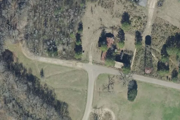
Obtenez la coordonnée GPS exacte de ce lieu abandonné situé dans le département Hinds (Mississippi, United States). Spot urbex vérifié et géolocalisé.
The Mississippi River Basin Model was a large-scale hydraulic model of the entire Mississippi River basin, covering an area of 200 acres. It is part of the Waterways Experiment Station, located near Clinton, Mississippi. The model was built from 1943 to 1966 and in operation from 1949 until 1973.
0,90EUR
Paiement unique - accès à vie
100% Secure Checkout
AMEX
Google Pay
stripe
SSL encrypted · No banking data stored
Ce qui est inclus
- Coordonnée GPS exacte
- Photo satellite du spot
- Accès immédiat après achat
This place appears in these articles

What our articles say about this place
Sources: Wikipedia - Rodney, MississippiRead the article : Abandoned Places in Mississippi: 6 Best Sites (Free GPS) →