Urbex mapa Liberty
57 opuštěná místa v Liberty
57
spoty
Jednorázová platba: doživotní přístup
Pravidelné aktualizace dostupné na celý život
Všechna opuštěná místa v Liberty
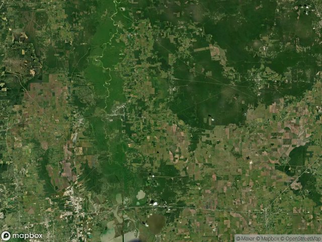
57 ověřené souřadnice GPS v kraji Liberty, Texas, Spojené státy.
Hledáte opuštěná místa v Liberty, Texas, Spojené státy? Urbex Maps nabízí 57 ověřených GPS souřadnic opuštěných budov v této oblasti, včetně .
57
ověřených míst
GPS
Google Maps, Waze
červen 2026
poslední aktualizace
Kde najít opuštěná místa v Liberty?
Opuštěná místa v Liberty najdete nejlépe přes interaktivní urbex mapu Urbex Maps s 57 ověřenými GPS souřadnicemi.
Spots v Liberty

Boyt Heirs Gathering

CR 1900

CR 1900

Cattle Guard

Chambers County, Texas

Echoes of Latent Nodes
Hardin Gas Gathering System

Hedge Row Road

Hedge Row Road

Humble to Liberty

Jose Coronado to Transco

Krahl Road

Krahl Road

Liberty County, Texas

Liberty County, Texas

Liberty County, Texas

Liberty County, Texas

Main Road

Main Road
Main Street, Daisetta

Moore Settlement

National Pipe & Tube Lateral

Palmer Road

SXL Intrastate Gathering

SXL Intrastate Gathering

SXL Intrastate Gathering

SXL Intrastate Gathering

SXL Intrastate Gathering

SXL Intrastate Gathering

SXL Intrastate Gathering

SXL Intrastate Gathering

SXL Intrastate Gathering

SXL Intrastate Gathering

SXL Intrastate Gathering

SXL Intrastate Gathering

SXL Intrastate Gathering

SXL Intrastate Gathering

SXL Intrastate Gathering

SXL Intrastate Gathering

SXL Intrastate Gathering

SXL Intrastate Gathering

SXL Intrastate Gathering

SXL Intrastate Gathering

SXL Intrastate Gathering

SXL Intrastate Gathering

SXL Intrastate Gathering

SXL Intrastate Gathering

SXL Intrastate Gathering

SXL Intrastate Gathering

SXL Intrastate Gathering

Shadows in the Grid

Sour Lake

Sour Lake

Sour Lake

Sour Lake to Hankamer

Westcott

Winnie